The Mediterranean and wider EMEA region are facing an extreme wildfire period, driven by persistent drought conditions, severe heat, and rapidly changing fire weather. In July 2025, Türkiye recorded 50.5°C, the first time the country observed temperatures above 50°C, while Southeast Europe and Türkiye experienced intense heatwaves and wildfire activity.
Across the region, Greece, Türkiye, Spain, Portugal, and other countries have faced major wildfire outbreaks, evacuations, and escalating pressure on emergency services. The 2025 European fire season later became the most severe documented in the EU, with more than 1 million hectares burned across 25 EU Member States, according to Copernicus Emergency Management Service reporting.
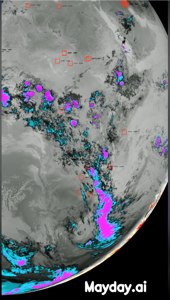
During a recent 48-hour monitoring window, Mayday.ai’s AI-powered wildfire detection engine tracked more than 3,000 fire-start detections across EMEA. Integrated with the Esri platform, the system provides near-real-time wildfire intelligence, updating every 10 minutes across global coverage areas to support firefighters, emergency managers, civil protection agencies, and communities.
Mayday.ai’s wildfire detection engine combines multi-source Earth Observation data, AI-based detection logic, geospatial analytics, and automated post-event mapping. The platform is designed to help users detect emerging wildfire activity earlier, monitor active events, and generate intelligence products that support response, recovery, insurance workflows, and resilience planning.
As part of Mayday.ai’s XPRIZE Wildfire efforts, the company plans to provide free access for humanitarian and emergency services worldwide starting in September 2025 through its Esri-enabled platform. The mission is to make advanced wildfire intelligence available to those on the front lines of climate and disaster response.
“Our goal is to help emergency services and humanitarian users see wildfire risk earlier, act faster, and protect more communities,” said Kian Mirshahi, Founder and CEO of Mayday.ai. “With global wildfire updates every 10 minutes, U.S. updates every 5 minutes, and enhanced one-minute monitoring in selected high-cadence regions, we are demonstrating the power of multimodal AI, satellite data fusion, and AI agents for real-time disaster intelligence.”
Mayday.ai is also preparing to release a similar product for real-time flood detection and monitoring, slated for early October 2025. Together, these capabilities represent an important step toward Mayday.ai’s broader mission: building AI-powered early warning systems for wildfires, floods, and other climate-driven hazards.
